


By Ruben A. Veloria
IBA, Zambales – The Provincial Engineering Office here belies reports on Wednesday that dredging has caused the damage of many establishments in coastal towns here, saying instead the structures were built in declared non-habitable areas.
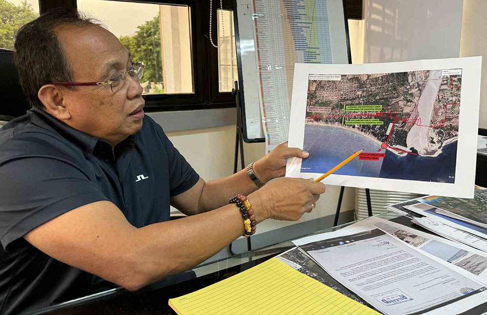
Zambales Provincial Engineer Domingo Mariano said alarming violations committed by resort owners triggering grave risks to the public, including visiting beach goers, in the towns of San Felipe and San Narciso.
This is after an inspection team headed by Mariano was conducted after some resort owners raised the alarm among the public regarding the deterioration of their properties built along the seashore and blamed the dredging operations in the province.
However, the survey of the area the ZPEO discovered that almost all of resort facilities were illegally constructed along the seashore of the said towns which is officially classified as “Public Land” by the Department of Environment and Natural Resources (DENR) and carries explicit “Non- Habitable” warnings due to extreme danger from wave action and soil instability.
Engr. Mariano said that the structures are violating the national environmental standards and safety regulations in coastal construction projects, spotlighting the grave risks of unpermitted development along the province’s fragile shoreline, which is why the government declared them as high-risk zones.
Meanwhile, the Mines and Geosciences Bureau (MGB) stated that dredging operations are not responsible for the severe coastal erosion affecting resorts in Barangay Liwliwa, San Felipe, Zambales.
MGB Region III Regional Director Noel Lacadin explained, “There was coastal erosion before dredging began. Therefore, based on situational analysis, dredging is not the problem here.”
The MGB emphasized the significant geological impact of the 1991 Mount Pinatubo eruption on the Zambales coastline.
Lacadin said, “When Pinatubo erupted, it expelled billions of cubic meters of volcanic material which either covered the volcano’s foot slopes or flowed into the sea through rivers.” After decades of lahar flows, the current shoreline was moved one kilometer toward the sea from its pre-eruption position.
“This means the coastline around San Felipe and San Narciso has advanced by at least kilometer compared to the 1977 shoreline, therefore those land built on unclassified public land formed by natural accretion or deposition of sand and sediment is accretionary, meaning it has no title,” said Lacadin.
Lacadin warned that structures should not have been built along the shoreline in the first place.
Meanwhile, San Felipe Mayor Reinhard Jeresano defended the dredging activities in the town, saying dredging is essential to mitigate flooding in the municipality, exacerbated by heavy siltation in their river.
“The town’s problem is constant flooding. If you go upstream, the riverbed is 20 to 30 meters higher than the surrounding land. All the water from the mountains flows through here first before reaching the sea,” Jeresano said.


