


By Ruben A. Veloria
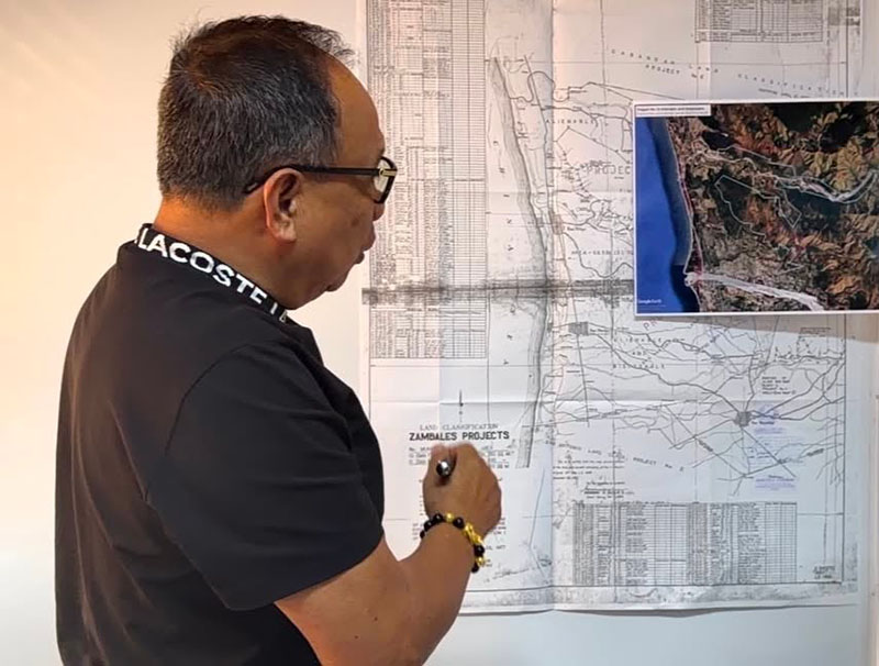
IBA, Zambales — The Provincial Government of Zambales has released a map which is said will resolve all issues regarding ownership of the land in the province which were classified as accretion by the Department of Environment and Natural Resources (DENR).
The map was released by the National Mapping and Resource Information Authority (NAMRIA) and certified by Marlyn Tabuñar, officer-in-charge of Land Classification Division, Resource Data Analysis Branch, and dated June 20, 1926, and can be easily determine the legitimacy of the land owned by private entity, or if it remains part of the non-disposable public land.
NAMRIA is the sole government agency mandated to carry out land classification and surveying. NAMRIA certifies if the land is unclassified as public non-disposable land that could not be owned by any person, or alienable and disposable which can be owned legally.
Recently, the local government of San Felipe, the Provincial Government of Zambales, and the Community Environment and Natural Office (CENRO)- Olongapo, conducted a delineation and reclassification of unclassified public land towards Alienable and Disposable (A&D) status.
The action aims to resolve the long-standing issue on land along the coastal area which is believe to illegally occupied or owned by resort owners or operators by showing suspicious tax declarations and other documents; encroaching on declared danger zones, and ignoring DENR Notices of Violation. Mines and Geosciences Bureau (MGB) warned that the land currently occupied by the resorts has no legal titles, the structures were built without building permit and violates building codes.
A certification from CENRO or PENRO, and a copy of the original certification of land classification duly approved by DENR Secretary, is the only instrument recognized by the law, and merely occupying the land even for long years does not carry legal rights.
The coastal area of Barangay Sto. Niño, especially the Sabangan, which is now known today as “Liw-liwa”, where beach resorts are found with their luxurious and huge permanent structures built by foreign and big Filipino investors, is among the expected to be affected.
Engineer Domingo Mariano, Consultant on Infrastructure Project ng Zambales, explained that the map shows that informal settlers just could not claim accretion land, and it is disallowed by the Department of Environment and Natural Resources (DENR).
Mariano added added that the map shall serve as evidence and reference of the law that will help to remove all structures inside the accretion. He also pointed that a copy of the map will be given to LGU San Felipe to be used as reference of the law in removing the structures over accretion and maintain the safety of the general public.