

By Debbie E. Gasingan
CORDILLERA, Philippines — The Department of Environment and Natural Resources (DENR) emphasized the importance of the proper use of geohazard maps to help prevent loss of lives and minimize damage to properties during calamities.
Speaking during the Luntiang Bukas: Patents, Permits and Partnerships at the DENR-CAR Training Center on August 4, 2026, DENR Secretary Juan Miguel Cuna directed the regional office to ensure that the geohazard maps provided to the local government units are being utilized.
“We have been providing geohazard maps to all local government units throughout the country for many years already but it’s actual use is what is more important, what is more significant because that would provide them the basis for their land use plan, for the different zones within their areas of jurisdiction so that every time we have calamity, we can prevent more loss of lives and damage to properties if we use these geohazard maps properly,” Cuna said.
The DENR-MGB geohazard maps are detailed scientific tools that identify communities susceptible to rain-induced landslides, floods, and storm surges that could serve as a guide for disaster preparedness, evacuation planning, and urban zoning.
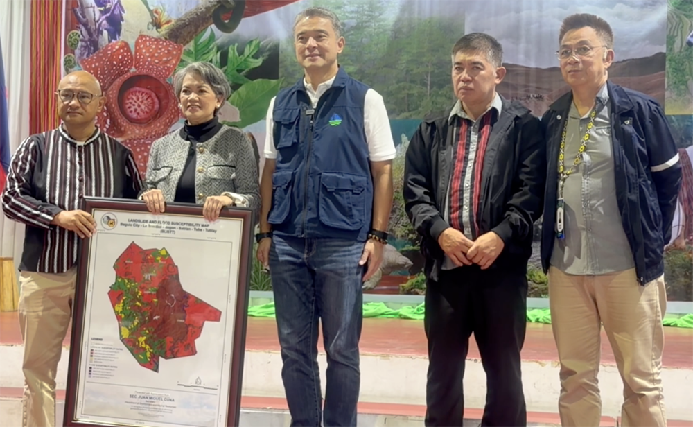
During the program, the DENR and Mines and Geosciences Bureau turned over a geohazard map to the Baguio-La Trinidad, Itogon, Sablan, Tuba, Tublay (BLISTT) areas.
Cuna said this is part of their mandate to protect not just the environment but also lives.
“By distributing BLISTT geohazard maps, we are embedding science into our governance. We are arming our local government units with the data needed to mitigate disasters and manage our forests, mountains, and urban centers with precision,” the secretary said.
Assistant Secretary Maria Monica Costales, administrator of the Metropolitan BLISTT Development Authority, also emphasized that the geohazard maps must not only remain on paper, but must guide preparedness and response.
She also reaffirmed their commitment to safeguard the environment while advancing development in the BLISTT area.
“The use of this geohazard map should not only be in paper or map but it should signify the safety of the communities of the BLISTT. Since DENR is our partner in so many of our services, then we also are committing ourselves to take care of the environment and eventually take care of people, safety, that would lead to the realization of the reason why we are here, that we are here to accelerate social and political development of the BLISTT area, as the BLISTT area is the economic nucleus of the Cordillera Administrative Region,” Costales said. (JDP/DEG-PIA CAR)